Infrastructure
Hyderabad Metro Phase II To Expand With Six New Corridors, Connecting The Upcoming Fourth City
V Bhagya Subhashini
Sep 30, 2024, 02:56 PM | Updated 03:44 PM IST
Save & read from anywhere!
Bookmark stories for easy access on any device or the Swarajya app.


Hyderabad Airport Metro Limited (HAML) is planning a significant extension of its metro line, connecting the Rajiv Gandhi International Airport at Shamshabad to the proposed 'Fourth City' via Mansanpally Road and the Outer Ring Road (ORR).
The development of this new city features ambitious plans, emphasizing multifaceted growth in sectors including education, medicine, sports, electronics, and electrical industries.
The new stretch, which will cost an estimated Rs 8,000 crore, will cover 40 km, with 2 km underground near the airport, 20 km elevated, and 18 km at road level. This extension will be part of a larger greenfield road project, providing better connectivity to the growing Skill University area.
The airport metro extension is part of the ambitious 116.2 km Phase II project, expected to cost Rs 32,237 crore. This project includes five additional metro corridors with a combined cost of Rs 24,237 crore.
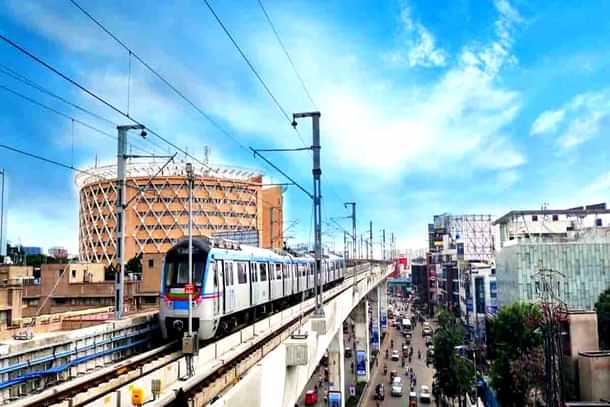
These new corridors will form a vital part of Hyderabad's growing public transportation network, connecting key areas like Kokapet Neopolis, Old City, Patancheru, and Hayatnagar.
The proposed corridors will be implemented through a joint venture between the Telangana government and the central government, similar to other metro projects across India.
New Alignments Cleared, DPRs To Be Finalised Soon
Chief Minister A Revanth Reddy approved the metro extensions in a recent meeting aimed at finalising the new alignments. The Detailed Project Reports (DPRs) for the project are currently in the final stages, with the Hyderabad Metropolitan Development Area (HMDA) conducting a traffic study under the Comprehensive Mobility Plan (CMP).
Once the CMP report is ready, the DPRs will be submitted for approval by the central government. HAML Managing Director NVS Reddy presented the details of the alignment and the station locations during the meeting.
The new airport metro corridor will span 36.6 km from Nagole to the airport via major hubs like LB Nagar, Karmanghat, Chandrayangutta, and Aramghar.
The route will include 24 stations, with 35 km elevated and 1.6 km underground, terminating at the Shamshabad Airport.
The extension is expected to enhance airport connectivity and link with existing metro lines at key stations such as Nagole, LB Nagar, and Chandrayangutta.
One of the most anticipated expansions is Corridor VI, which will extend the Green Line from MGBS to Chandrayangutta, passing through the Old City. This 7.5 km corridor will pass iconic locations like Shalibanda Junction and Falaknuma, with station names retaining their historical significance.
To accommodate the metro, the road from Darulshifa Junction to Chandrayangutta is being widened to 100 feet, with some areas extended to 120 feet at station locations.
The alignment will affect around 1,100 properties, of which 400 have already received notifications for acquisition. Despite challenges, HAML has committed to preserving 103 sensitive structures, including religious and heritage sites, through innovative engineering solutions, according to a report by Deccan Chronicle.
Additional corridors under the Phase II plan include Corridor V, which will connect Raidurg to Kokapet Neopolis over 11.6 km, passing through Hyderabad’s financial district.
Corridor VII will extend the Red Line from Miyapur to Patancheru, a 13.4 km stretch along the Mumbai highway, while Corridor VIII will extend the Red Line from LB Nagar to Hayatnagar, covering 7.1 km along the Vijayawada highway.
These wholly elevated corridors will feature stations at strategic points, improving connectivity for thousands of commuters.
V Bhagya Subhashini is a staff writer at Swarajya. She tracks infrastructure developments.


